


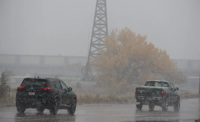

A winter storm is set to impact central Wyoming over the next couple of days, prompting the Wyoming Department of Transportation (WYDOT) and the Casper Police Department (CPD) to issue warnings for drivers to exercise caution.
Snow, strong winds, and icy conditions are expected to create hazardous travel conditions across much of the region.
WYDOT is urging all motorists, particularly those traveling to school sporting events, to remain alert and plan for possible travel delays. Several major highways, including Interstate 80, Interstate 25, Interstate 90, Wyoming Highway 28/South Pass, and US Highway 20/26, are under Winter Storm Warnings, Advisories, or Watches.
“The forecast calls for heavy snowfall, blowing snow, strong winds, and other wintry hazards,” WYDOT stated in a release.
Snowplows will be working throughout the storm, but drivers are reminded to give them space. WYDOT also noted that 10 snowplows have already been struck by other vehicles this season, emphasizing the need for caution.
Even with plows in operation, road conditions may remain hazardous. WYDOT advises motorists to reduce speed, avoid using cruise control, and stay alert for sudden weather changes. Additionally, they remind drivers to always wear seat belts and to never drive while impaired or distracted.
The Casper Police Department is also urging residents to take precautions as the storm approaches.
“With inclement weather on the way, please remember to slow down, drive cautiously, and share the road responsibly,” the department wrote in a social media post. “Snow, ice, and reduced visibility can make travel dangerous. Leave early to allow extra time and stay alert.”
In the event of a minor accident, CPD advises drivers to move their vehicles to a safe location if possible, helping to prevent additional crashes and keep traffic flowing.
“Let’s work together to keep the roads safe in our community!” CPD concluded.
WYDOT clarified that highway closures are not made preemptively but occur only when conditions become too dangerous due to whiteouts, drifting snow, or crashes. Driving on closed roads can endanger WYDOT plow operators and first responders.
For those who must travel, WYDOT offers the Wyoming Travel Authorization Program, which allows certain residents and workers to use closed highways when conditions are deemed safe. More details can be found on the program’s website: Wyoming Travel Authorization Program.
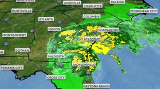
The National Weather Service in Riverton has upgraded its Winter Storm Watch to a Winter Storm Warning. The warning covers the Lander Foothills, Green Mountains, and Rattlesnake Range areas, including Dubois, Lander, Jeffrey City, Riverton, and Shoshoni.
Heavy snow is expected, with lower elevations potentially receiving 6 to 12 inches, while higher elevations could see 18 to 24 inches. Wind gusts up to 40 mph could create additional travel difficulties, especially in backcountry areas.
Snow will likely impact a large portion of southern, central, and eastern Wyoming from Thursday through early Friday. The heaviest snowfall is expected in Lander, Riverton, and Casper.
Jackson Hole and Teton County are expected to dry out on Friday, with a period of dry and sunny conditions extending through the weekend. However, another storm system is projected to arrive around Tuesday, March 11, possibly bringing more snow to the region.
Currently, snowpack levels in the Teton region remain slightly above average following a snowy February. The active weather pattern expected in mid-March may help maintain or increase these levels.
With input from Oil City News, County 10, and Buckrail.

The latest news in your social feeds
Subscribe to our social media platforms to stay tuned