


New Study Maps Landslide Risk in Teton County with Unprecedented Detail

A newly released study by the Wyoming State Geological Survey (WSGS) offers a comprehensive look at where deep-seated landslides are most likely to occur in central and southern Teton County, K2 Radio reports.
The study comes as part of ongoing efforts to better understand and manage geological hazards in one of Wyoming’s most landslide-prone areas.
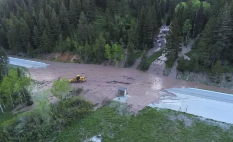
Landslides are a regular feature of the state’s dynamic landscape, but Teton County has seen some of the most severe events, including the historic Gros Ventre Slide in 1925 and more recent disruptions like the Budge Drive and Big Fill landslides. These incidents have caused significant infrastructure damage and economic losses.
The WSGS report, titled Susceptibility to Deep-Seated Landslides in Central and Southern Teton County, Wyoming, includes a high-resolution susceptibility map, a technical report, and digital GIS data. These tools are designed to aid local planners, emergency managers, and property owners in making informed decisions about land use and risk mitigation.
“Teton County is one of the most landslide-prone parts of the state,” said James Mauch, WSGS geologist and lead author of the report. “Thanks to detailed geologic mapping and lidar elevation data, we’ve been able to deliver one of the most accurate and detailed models of landslide susceptibility in Wyoming.”
The model, which uses a 10-meter resolution raster grid, evaluates slope angles and rock strength across a large portion of the county. It was validated against an independent inventory of over 2,100 documented landslides. Findings show that approximately 84 percent of the study area is at least marginally susceptible to deep-seated landslides, underscoring the region’s inherent geologic risk.
The study reveals significant variation in landslide susceptibility across short distances, particularly in mountainous areas where geologic and topographic conditions fluctuate rapidly. The map offers important insights for both long-term planning and immediate hazard awareness.
“This is an excellent example of how geoscience can support public safety and smart land-use decisions,” said Dr. Erin Campbell, WSGS Director and State Geologist. “Our goal is to translate geologic data into practical tools that help communities prepare and respond more effectively.”
The report does outline some limitations, including that it focuses solely on deep-seated landslides and excludes other types of mass movement such as rockfalls and debris flows. Additionally, the model does not predict when or how frequently landslides might occur, nor does it factor in triggers like heavy rainfall or seismic activity.
All components of the study — including the technical report, map plate, and GIS datasets — are available for free download on the WSGS website.


The latest news in your social feeds
Subscribe to our social media platforms to stay tuned