


Hurricane Erin downgraded to Category 3, still packing dangerous winds

Hurricane Erin, the first hurricane of this year’s Atlantic season, has eased slightly but is still a powerful storm. The US National Hurricane Center (NHC) said Sunday that Erin is now a Category 3, down from a Category 4, with maximum sustained winds of 125 mph (205 kph).
The storm was about 330 miles (530km) southeast of Grand Turk Island, moving west-northwest at nearly 14 mph (22 kph). A slower speed and a turn north are expected Monday into Tuesday.
Just a day ago, Erin had peaked as a catastrophic Category 5 with winds of 160 mph (240 kph). It was forecast to keep strengthening, but conditions shifted.
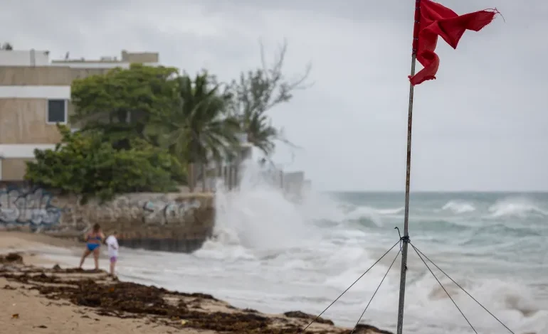
Even with the downgrade, Erin is sending out dangerous swells across the northern Leeward Islands, the Virgin Islands, Puerto Rico, Hispaniola, and the Turks and Caicos. Those waves will reach the Bahamas, Bermuda, the US East Coast, and Atlantic Canada in the coming days. Officials warn of life-threatening surf and rip currents.
The Bahamas has issued a Tropical Storm Watch for the nearby Turks and Caicos Islands. Local authorities are setting up shelters and urging residents to stay alert. In Puerto Rico, more than 360 shelters are ready if needed, according to Housing Secretary Ciary Perez Peña.
Meteorologists also warn that Erin could create wildfire risks if strong dry winds fan flames on already parched land, a rare side effect of a powerful offshore storm. The US government has deployed over 200 Federal Emergency Management Agency workers as a precaution.
Erin is the fifth named storm of the Atlantic hurricane season, which runs from June through November. Forecasters expect this season to be unusually busy, with up to 10 hurricanes and as many as five reaching major strength.


The latest news in your social feeds
Subscribe to our social media platforms to stay tuned