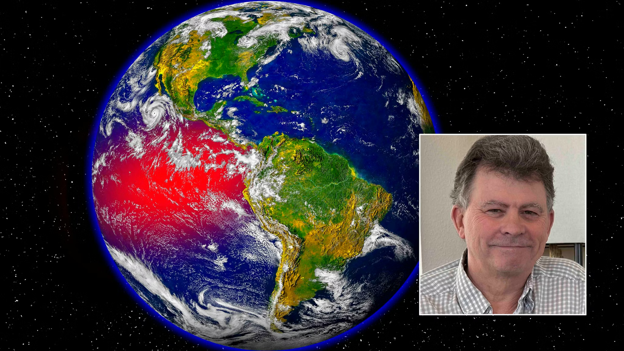


After the torturous winter that wasn’t, some meteorologists are seeing signs of another ominous weather event: a Super El Niño. Several meteorologists say an El Niño is forming over the Pacific Ocean, meaning ocean surface temperatures are getting warmer along the equator—a pattern with wide-reaching impacts across the Western Hemisphere. Some are going further, believing current conditions have the hallmarks of a Super El Niño with amplified impacts across the United States.
Ben Noll, a meteorologist with The Washington Post, predicted an 80% chance of a strong El Niño and a 22% chance of a Super El Niño by August, leading to “changes in location, intensity and frequency of droughts, floods, heat waves and hurricanes.” A Super El Niño would have favorable impacts on Wyoming’s upcoming summer by adding needed rain after a bone-dry winter. But Cowboy State Daily meteorologist Don Day isn’t buying the hype.
“There’s a very good chance that we are going to have an El Niño, but it’s very early to say it’ll be a ‘super’ El Niño,” Day said.
El Niño and La Niña are opposite phases of the same Pacific Ocean weather patterns. The Pacific has just phased out of a stronger-than-expected La Niña, which partly explains the record-breaking warm winter in the American West. “We very much under-forecasted the intensity of La Niña last fall,” Day said. “There was less than a 50% chance of a La Niña in the March forecast, but it came on in August and reached its peak in December.”
Day’s hesitation about adding “super” to the developing El Niño is twofold. First, there’s a timeline issue. “We’re in what’s called the spring predictability barrier, which means any predictions that are made months in advance in spring run the risk of a higher error rate.” Second, the lingering impacts of the Hunga Tonga-Hunga Ha’apai volcano eruption in 2022—which sent 150 trillion gallons of water into the stratosphere—could alter the anticipated behavior of any El Niño. “We don’t have any historical precedent for the Hunga Tonga eruption,” Day said. “We don’t know what this El Niño is going to interface with.”
When the Pacific is undergoing an El Niño, conditions in Wyoming are generally warmer and wetter. Day said the most recent forecast shows a 70% chance of El Niño conditions by May, June and July, with about a 45% chance it happens in April or May. A strong El Niño in late spring would make rainstorms more productive, helping alleviate the growing drought deficit across Wyoming. “That’s potentially really good news for us, as it could get us out of this dry cycle, but we have to tread carefully,” Day said. “We can’t make assumptions that this El Niño will be exactly like the previous ones.”
Day called the Super El Niño predictions “clickbait” and warned against getting too far out on long-range forecasts. “People get themselves in trouble all the time by going too far out,” he said. “It’s better to take it a little chunk at a time and see how things evolve. When we’re putting out predictions of what the summer, fall and winter are going to be like in a Super El Niño, you end up getting idealized outlooks that may or may not happen.”


The latest news in your social feeds
Subscribe to our social media platforms to stay tuned