

Heads up, deer hunters: Lines just shifted in Wyoming’s Hunt Areas 106 & 109
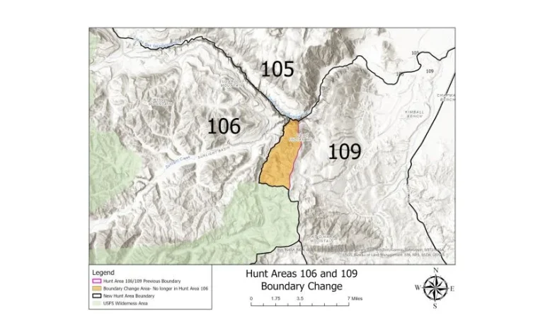
If you’re chasing deer northwest of Cody this fall, double-check your map. The Wyoming Game and Fish Department has redrawn the boundary between Deer Hunt Areas 106 and 109, and the change is already in effect.
The big tweak: the eastern edge of Area 106 now follows Dead Indian Creek. Everything on the Chief Joseph Highway switchbacks east of Dead Indian Creek is now Area 109 — and remember, 109 is a limited-quota area, not general.
Cody Region wildlife biologist Tony Mong says the move was mainly about safety during the late stretch of the general season in 106. Hunters and locals also raised repeated fair-chase concerns about shooting opportunities tight to the highway, which helped push the change forward.
Game and Fish floated the adjustment during March season-setting meetings; the Commission signed off in June. For the exact legal language, see page 42 of the 2025 Deer Regulations — and make sure your GPS maps and waypoints match the new line before you head out.
The original reporting by Tara Hodges for The Wyoming Game and Fish Department.


The latest news in your social feeds
Subscribe to our social media platforms to stay tuned