More Sun, More Risk: Wyoming’s Soaring Daylight Hours Herald a Dangerous Season for Snow

The days are lengthening, the angle of the sun is climbing, and the immense, quiet energy of a changing season is in motion. Wyoming, having endured an anomalously warm and nearly snowless winter, is now entering the three-month period known as “solar spring.” Beginning February 5th and stretching to May 5th, this is the time of year when daylight rapidly expands, and temperatures slowly, inexorably, begin their climb. But this annual shift carries a significant, often overlooked threat: the increased potential for crippling, heavy, wet snowstorms that can bring entire cities to a standstill.
From February 1st through February 28th, Wyoming will gain more than 70 minutes of daylight. The change is most perceptible in the evenings, where the fading light holds on a little longer each day. This increased solar radiation doesn’t just brighten the landscape; it fundamentally alters the atmosphere’s capacity for precipitation.
“The warmer the air is, the more water it can hold,” explains Don Day, a meteorologist with Cowboy State Daily. “We don’t get much snow from Arctic fronts because that air is always very dry. As the days get longer, the air warms up, and the natural water content in the air rises.”
This is the double-edged sword of the coming months. The state’s driest period—December, January, and February—is giving way to its wettest: March, April, May, and June. The storms that arrive are no longer the dry, powdery snows of deep winter. They are moisture-laden systems capable of dropping snow measured in feet, not inches, and of a consistency closer to concrete than to frost.
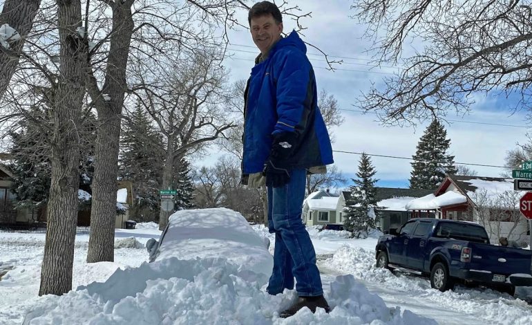
The memory of what such a storm can do is still vivid in Cheyenne. From March 13th to 14th in 2021, a single storm system buried the capital city under over 30 inches of snow in a 24-hour period. The wet, cement-like snow collapsed roofs, snapped tree limbs onto power lines, and made roads impassable. Mayor Patrick Collins described the scene as a “zombie apocalypse,” urging residents to stay inside—an order that remained in place three days after the snow had stopped falling. Digging out took days, and for some, a full week.
“The problem this year,” says Chris Jones, a meteorologist who has tracked these seasonal shifts, “is that we’re entering this volatile period with a profound deficit. The ground is bare, the air has been warm, and the snowpack in many areas is non-existent.” January was one of the warmest on record for Wyoming, and February has continued the trend. The lack of a reflective snow cover has allowed the sun’s energy to warm the earth more efficiently, creating a feedback loop of mild conditions.
This sets the stage for a precarious meteorological gamble. If and when a strong storm system finally taps into Pacific moisture and pushes into the region, it will encounter an atmosphere primed to hold and release vast quantities of precipitation. The result would not be a gentle return to winter, but a sudden, violent overload.
“The key is the Pacific,” Day emphasizes. “We’ve been shut off from those systems all winter. We need that wet air to combine with a cold front. If we can finally get those fronts and storms to come to the west, they’ve got more water to work with.”
The increased sun angle also plays a crucial role. Noah Myers, a meteorologist with the National Weather Service in Riverton, notes that as the sun climbs higher, its rays strike the ground more directly, accelerating any thaw and making it harder to sustain prolonged cold spells at lower elevations. “We are entering the time of year where locations east of the Continental Divide get the most moisture,” Myers says. “There’s still the potential for some bigger snowstorms, but we’ve already missed the mark for really cold weather with no snow on the ground.”
Long-range models are hinting at a possible pattern change in mid-February, with Arctic air finally making a southward push toward the Western United States. Meteorologists are watching closely to see if this cold air will successfully link up with the Pacific moisture pipeline. Day sees this as the critical test for the remainder of the season. “We need the weather to get going and bring us the precipitation,” he states. “If we do not see this phase change next week that continues into March, that’s going to be a huge concern.”
For ranchers and water managers, the type of snow that falls is as important as the amount. The heavy, wet snow of spring is a far more efficient water source than the dry powder of January. “The best thing about spring snow in Wyoming is that it melts more than it evaporates,” Day points out. “If you get a big snow dump in November or December, it’ll be on the ground all winter and much of it sublimates back into the air. Spring snow soaks into the ground.” This makes the coming storms vital for replenishing soil moisture, stock ponds, and stream flows ahead of the summer.
So, as Wyoming enjoys the welcome gift of longer, brighter evenings, a complex and potentially dangerous weather transition is underway. The state stands at a crossroads between a failed winter and a volatile spring. The increasing solar energy promises warmth and growth, but it also empowers the atmosphere to deliver storms of remarkable ferocity. The coming weeks will determine whether the season shifts gently or announces its arrival with a paralyzing, historic blow.


The latest news in your social feeds
Subscribe to our social media platforms to stay tuned