


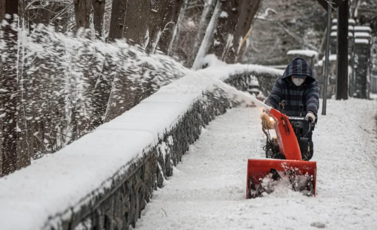

Across the continental United States, winter is making a dramatic return with a series of powerful storms poised to unleash heavy snow, freezing rain, and dangerously low temperatures, as much as 35 degrees below seasonal averages, NBC News reports.
Currently, over 32 million Americans are under winter weather alerts as a potent system prepares to blanket areas from northern Kentucky to West Virginia, the Washington D.C. metro area, Maryland, and parts of the Ohio Valley and Mid-Atlantic with heavy snow.
The storm, slated to arrive Tuesday, is expected to drop between 4 and 8 inches of snow, potentially falling at a rate of 1 inch per hour, particularly impacting the I-95 corridor. Commuters should anticipate hazardous driving conditions, especially during Tuesday evening’s rush hour.
Further west, Kansas faces the possibility of up to 10 inches of snow, with significant accumulations expected along and north of the I-70. Simultaneously, the same storm will bring heavy rain to the South and Southeast, raising concerns about localized flooding.
Adding to the challenges, the Appalachians, stretching from northern North Carolina into Virginia, are bracing for potential ice accumulations of up to 0.5 inches of freezing rain. This poses a significant risk of dangerous travel conditions and potential power outages.
An Arctic blast will plunge temperatures 25 to 35 degrees below average across the Northern Rockies, Upper Great Lakes, and Central High Plains, triggering an extreme cold weather warning from the National Weather Service. North Dakota is expected to experience wind chills as low as -55 degrees Fahrenheit, creating life-threatening conditions.
Adding insult to injury, a second winter storm is forecast to impact many of the same areas from Wednesday into Thursday. This system will bring more snow to the Midwest and Great Lakes, as well as additional rain and ice to the Mid-Atlantic. The Lower Mississippi Valley and the wider Southeast are also predicted to experience heavy rain and thunderstorms.
The barrage of winter weather doesn’t stop there. A third storm is projected to sweep across the Midwest to the East Coast this weekend, adding to the already significant strain on affected regions.
Beyond the snow and ice, Utah is facing a heightened avalanche risk. Drew Hardesty of the Utah Avalanche Center reported that a skier triggered a 200-foot wide avalanche on Mount Superior on Monday. Fortunately, no injuries were reported, but the incident serves as a stark reminder of the dangers. Tragically, avalanches in Utah have already claimed the lives of four people this year.
Even the West Coast is not immune to the cold snap. A storm system is expected to arrive in California late Wednesday, bringing rain and snow to higher elevations. Los Angeles Mayor Karen Bass is scheduled to hold a news conference at 9 a.m. PT Tuesday to address preparations ahead of the storm.


The latest news in your social feeds
Subscribe to our social media platforms to stay tuned